Thursday 25 November 2010

Wayanad

Located in the north-east of Kerala, India, was formed on November 1, 1980 as the 12th district by carving out areas from Kozhikode and Kannur districts.
Population : 780,619
Area          : 2131 km2
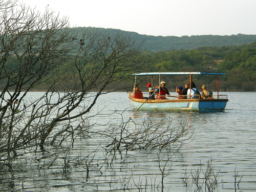
Wayanad is relatively less touristy, unexplored and unexploited area of Kerala. This lies high in the Western Ghats, and is home to a few wildlife sanctuaries, tall hills and tea estates. Kalpetta is the largest town and district headquarters of Wayanad. There are many places to see and activities to do. Directions and tourist information is easily available once you reach there, so don't worry much about the homework and just arrive here to explore more.According to archaeological evidence, the Wayanad forests have been inhabited for more than three thousand yearsThe Kabini River, one of the three east flowing rivers of Kerala, is an important tributary of the Kaveri River. Almost the entire Wayanad district is drained by Kabini and its three tributaries, the Panamaram, Mananthavady, and Kalindy rivers. The Banasura Sagar Dam is built on one of tributaries of the Kabini River.Wayanad is one of the districts in Kerala that have been able to retain its pristine nature. This green paradise is nestled among the mountains of western ghat and is located at a distance of 76 km from the nearest seashore of Kozhikode.The district is very susceptible to an agrarian crisis, due to the high dependence of the population on agricultural income.
                                           Eco places in Wayanad                                     
Edakkal caves

Edakkal caves :
12 kms from Sulthan Bathery. 3 caves are located at a height of 1000 mts on Ambukuthi mala near Ambalavayal. The new stone age pictorial writings on the walls of these natural caves at Edakkal are the evidence of the civilizations that existed in the regions in the pre-historic times. The caves can be accessed only by a 1Km trekking trail from Edakkal. Morning hours are the best time to visit these caves. Entry is permitted only upto 1700 hrs. An interesting trek up of the Ambukuthi Hill near Ambalavayal town takes you to this fascinating neolithic cave site. Etchings found on the walls of these caves have drawn the serious attention of archeologists and historians worldwide.With at least three distinct sets of petroglyphs, the earliest thought to date back over 3000 years, it is assumed that the Edakkal caves had been inhabited at various stages in history.
Distances from: Kalpetta-27 Km, Sulthan Bathery-12 Km, Mananthavady-45 Km


Chembra peak :
At 2100 mts above mean sea level, Chembra is the highest peak in Wayanad and is ideal for trekking. Climbing this peak is a challenging mountaineering endeavour and would take a full dayThe scenic beauty of Wayanad, which is visible from the top of Chembra, is very exhilerating. The surrounding areas offer exceptional photo oppurtunities. Camping on the peak is an unforgettable experience. District Tourism Promotion Council provides guides, sleeping bags, canvases, huts and trekking implements on hire.
Distances from: Kalpetta .-14 Km, Sulthan Bathery -42 Km, Mananthavady -52 Km

Sunrise Valley
Sunrise Valley :
As the name indicates, Sunrise Valley is a great place to watch the rising and setting sun set amidst dramatic mountain scenery. The place also offers a panoramic view of the valley beneath with the River Chaliyar meandering along.Sunrise Valley provides some excellent trekking opportunities in Wayanad. Sunrise Point, which overlooks the valley, is located near by kanthampara falls 22 kms far from sulthan bathery and 22 kms from kialpetta.

Neelimala View Point :
Closer to Vaduvanchal, Neelimala is an excellent venue fro trekking with lots of stimulating trails. The summit of this hill affords a great view of the cascading Meenmutty fallsand the beautiful valley in its foreground.
Distances from: Kalpetta-27 Km, Sulthan Bathery-26 Km, Mananthavady-62 Km

Meenmutty falls :
An interesting 2 km jungle trek off the main Ooty road, Meenmutty is the largest and most spectacular waterfall in Wayanad. A unique feature is that water drops about 300 metres over three stages.
Distances from: Kalpetta-37 Km, Sulthan Bathery-12 Km, Mananthavady-54 Km

Soochippara waterfall
Sentinal Rock Waterfalls:
22 kms south of Kalpetta near Chooralmala. Locally known as Soochippara and is a very popular leisure destination. This is a three step waterfall more than 200 mts in height. Framed by enchanting scenery. A must to see site! This region is ideal for rock climbing. Soochipara can be reached by a scenic 2 kms. nature walk and deer and other wildlife can be seen near the waterfront.
Distances from: Kalpetta-22 Km, Sulthan Bathery-43 Km, Mananthavady-58 Km

Kanthanpara waterfalls :
22 kms south east of Kalpetta and 8 kms east of Meppadi, a beautiful waterfall about 30 mts in height. Relatively smaller than Sentinel Rock falls, and rather less frequented Kanthanpara and its surroundings offer a very pleasant site. A easy hike away from the main road, its perfect for picnics.
Distances from: Kalpetta-22 Km, Sulthan Bathery-23 Km, Mananthavady-57 Km
Banasura sagar dam

Banasura sagar project :
This is the largest earth dam in India and the second largest in Asia is being built here. The topography here is such that many islands will be formed in the upstream of the dam when the dam is full. These islands with the background of the Banasura hill will provide a hypnotising sight to tourists.Situated at Padinjarathara  21 kms north east of Kalpetta. Situated at Padinjarathara.  The Banasura project precincts are an ideal starting point for treks to the Banasura Peak. A quaint feature is a series of islands that were formed when the reservoir submerged the surrounding areas.
Distances from: Kalpetta-21 Km, Sulthan Bathery-47 Km, Mananthavady-34 Km 

Chethalayam Falls :
Chethalayam is one of Wayanad's smaller waterfalls. Its surroundings offer a number of vantage points for bird-watching. It is also popular with trekking enthusiasts.
Distances from: Kalpetta-37 Km, Sulthan Bathery-12 Km, Mananthavady-54 Km

wild life sanctuary, Muthanga
Wayanad wild life sanctuary, Muthanga :
Established in 1973, the Wayanad wild life sanctuary is contiguous to the protected area network of Nagarhole and Bandipur of Karnataka on the north-east and Muthumalai of TamilNadu on south-east. Rich in bio-diversity, the sanctuary is an integral part of the Nilgiri Biosphere Reserve, which has been established with the specific objective of conserving the biological heritage of the region. The sanctuary is rich in flora and fauna. The management lays emphasis on scientific conservation with due consideration for the general life styles of tribals and others who live in and around the forest.
The vegetation is predominantly moist deciduous forest with small stretches of swamps, teak forests, bamboo and tall grass. Amidst such fertile and varied flora, this region hosts several rare herbs and medicinal plants.
With numerous watering holes Muthanga has a large population of pachyderms, and has been declared a Project Elephant site. Also Jungle Cats, Panthers, Civet Cat, Monkeys, Wild dogs, Deers, Spotted Bears, Bisons, Gaurs, Cheetah, Wild Bears, Peacock, Owls, Jungle fowls, Woodpeckers, Babblers, Cukoos etc.. can be seen here. The reserve is also home to a small population of Tigers. Elephant rides are arranged here by the forest department. Click here for more...


Reaching Wayanad

By Air
The nearest airport from Wayanad is the Karipur airport of Kozhikode. It is situated at a distance of around 100 kilometers from the city. There are regular flights from the airport to other states in India, like Chennai, Mumbai, Delhi, and Goa and even international destinations like Sharjah, Dubai, Abu Dhabi, Kuwait, Bahrain, Doha and Muscat. You can also access Wayanad from the Cochin International Airport, which is at a distance of around 300 kilometers.

By Rail
The nearest railway station from Wayanad is at Calicut, at a distance of around 110 kilometers from this place. It is well connected by a good network of railways. There are a number of local as well as inter-state trains that halt at the Calicut station and connect it with the other major cities of India. From the station, you can take a bus or hire a can for going to Wayanad.

By Roads
Wayanad is well connected by a wide network of roads and this place can be easily accessed from anywhere in Kerala as well as from neighboring states. For reaching Wayanad by road, NH212 and SH17 are the highways that you need to follow. Otherwise, you can take a bus or hire a cab. Deluxe buses are available for Wayanad, from Bangalore’s Majestic Bus Stand, from 9 am to 10 pm.


Monday 22 November 2010

Arunachal Pradesh

Arunachal Pradesh is a state,  located in northeast India.It borders the states of Assam and Nagaland to the south, and shares international borders with Burma in the east, Bhutan in the west, and the People's Republic of China in the north.
Population : 1,091,120 (26th)
Area          :  83743 km2 (32333 sq mi)
Much of Arunachal Pradesh is covered by the Himalayas. However, parts of Lohit, Changlang and Tirap are covered by the Patkai hills. Kangto, Nyegi Kangsang, the main Gorichen peak and the Eastern Gorichen peak are some of the highest peaks in this region of the Himalayas.It is the land of rising sun, is one among the the most beautiful states of north-east India. Exploring its Himalayan hills full of variety of exquisite flora and fauna is a feast for nature lovers. Splendid game viewing in four of its wildlife sanctuaries, sightseeing hundreds of orchid species in orchid sanctuary, enjoying climbing and trekking in plenty of Himalayan hills are merely some among the numerous Eco activities that keep tourists engaged while touring Arunachal Pradesh.Getting its description in the world famous epic, Mahabharata, the culture and tradition of Arunachal Pradesh dates back to thousands years back, which tourists can witness even now preserved by tribals of Arunachal Pradesh. The rich tradition has made various artistic craftsmanship pass from one generation to following one. Beautiful masks, cane and bamboo, wooden carving are some of the livid example of craftsmanship of inhabitants of Arunachal, which has got wide recognition.The game viewing in many of its parks and sanctuaries let travellers encounter rare animals like Mishmi, Takin, Hoolock Gibbon, Musk Deer, Bharal, Hisbid Hare, Flying Squirrel and more than 500 species of birds. The Himalayan hills surrounding the state is origin of more than 500 species of orchids.

Eco places in Arunachal Pradesh

The Himalayan hills, and Four national parks and seven wildlife parks of Arunachal Pradesh are origin of evergreen forests, hills, rivers and many streams which are abode to many sightseeing natural places becoming popular tourist destination

Parasuramkund
Tinsukia - Tezu- Parasuramkund : 
Bhishmaknagar, Parsuramkund, Mehao lake, Salley lake, Mayadia.Situated in the lower reaches to the river Lohit. It is a religious place visited by people from all over the country during the Makar Sankranti day for a holy dip. Common belief that a dip on the day in the kund washes away one's sins. As recorded in the Kalika Purana that it was here the sage Parasuram washed away his sin of matricide.

Tezpur- Bhalukpong - Bomdila -Tawang : 

Orchid sanctuary, Buddhist gompa, Tawang Monestary, several waterfalls. On the Banks of the river, at an elevation of 190 metres is Tipi, a glass house with over 7,500 Orchids. From here the road is fairly steep as it soars up to the small headquarters of the West Kameng district. Bomdila at a height of over 2530 metre. It has a Tourist Lodge, a Craft Center, Apple Orchards and Buddhist Gomphas. There are also views of Himalayan landscapes and snow-clad ranges. Bomdila is a good place to rest overnight.

Margherita- Miao- Namdapha : 
Mountains of Arunachal Pradesh
Namdhapa National Park, Miao Mini Zoo, Tibetan camp.


Pasighat-Jengging-Yingkiong : 
Dr. Daying Ering Wildlife Sanctuary, Mouling National Park, Kekar Monying and Komsing.

Tezpur - Seijosa(Pakhui) - Bhalukpong - Tipi : 
Pakhui Wildlife Sanctuary, Seijosa, Bhalukpong, Orchidarium at Tipi.The grandeur of Arunachal not only lies in its colorful tribes but also in its rich flora and fauna. Orchids find a pride of place and more than 500 species are to he found in Arunachal alone. An Orchidarium has been act up to study this botanical paradise at Tipi (seven kilometers from Bhalukpong).

Itanagar- Ziro - Daporijo - Along - Pashighat : 
Itafort, Gekar Sinyi, Talley Valley, Menga Cave, D'Ering Wildlife Sanctuary, Mouling National Park

Reaching there
 By Air : Tejpur (225 km) is the nearest airport from Arunachal Pradesh. Tejpur has flights from Kolkata international airport (west Bengal), which is well connected to all major air locations in india and abroad. Even Itanagar has regular helicopter service with Guwahati on every Monday, Tuesday, Wednesday and Sunday. Now helicopter service has also been started withing the state for travellers and tourist convenience.

By Rail : the nearest railhead is harmuty, which is merely 33 km far from the capital, itanagar. But, Lakhimpur in Assam (60 km) is most convenient as it has good rail link with major destination like Guwahati.

By Road : Itanagar is well connected by road to Guwahati (429 km away) through national highway 52. Direct buses are available from Guwahati to Itanagar.

Saturday 20 November 2010

Lahaul and Spiti

The district of Lahaul-Spiti is located in  Indian state of Himachal Pradesh.This district is connected to Manali through the Rohtang Pass. To the south, Spiti ends 24 km from Tabo, at the Pare chu gorge where the road enters Kinnaur and joins with National Highway No. 22.
Population : 33,224 (2001)
Area          : 13,833 km2 (5,341 sq mi)
Lahaul and Spiti valley are two of the most remote valleys in Himachal Pradesh with a population density of only 2 persons per sq. Km. Green meadows, flowing streams, snowcapped mountains welcome you where ever you go in the summer.Of the two, the Spiti Valley is a barren mountain desert with the Spiti river rushing out of a gorge in the southeast to meet the Sutlej River. Lahaul is glacier country and some of its most dramatic glaciers include the Bara Shigri, Chota Shigri, Samundari and Sonapani glaciersOne of the most interesting places is the Tabo Monastery, located 45 km from Kaza, Himachal Pradesh, the capital of the Spiti region. This monastery rose to prominence when it celebrated its thousandth year of existence in 1996. It houses a collection of Buddhist scriptures, Buddhist statues and Thangkas. The ancient gompa is finished with mud plaster, and contains several scriptures and documents. Lama Dzangpo heads the gompa here. There is a modern guest house with a dining hall and all facilities are available.
Another famous gompa, Kardang Monastery, is located at an elevation of 3,500 metres across the river, about 8 km from Keylong. Kardang is well connected by the road via the Tandi bridge which is about 14 km from Keylong. Built in the 12th century, this monastery houses a large library of Buddhist literature including the main Kangyur and Tangyur scriptures.

Eco places in Lahaul and Spiti

The natural scenery and Buddhist monasteries, such as Ki, Dhankar, Shashur, Guru Ghantal and Tayul Gompas, are the main tourist attractions of the regionThe treacherous weather in Lahaul and Spiti permits visitors to tour only between the months of June to October, when the roads and villages are free of snow and the high passes (Rothang La and Kunzum La) are open. It is possible to access Spiti from Kinnaur (along the Sutlej) all through the year, although the road is sometimes temporarily closed by landslides or avalanches.

Spiti Valley

Spiti Valley: 
Spiti Valley is in the most northern part of Himachal Pradesh in India, running parallel to the Tibetan border. Spiti Valley has only been opened to tourists since 1992.The valley is blessed with the good population of snow leopards, ibex, Himalayan Brown Bear, Musk Deer, Himalayan Blue Sheep etc. which serves as the boon for the wildlife lovers. There are two important protected areas in the region that are a home to snow leopard and its prey including the Pin Valley National Park and Kibber Wildlife Sanctuary. Surprisingly, due to ardent religious beliefs, people of Spiti do not hunt these wild animals.
Apart from the exotic wildlife, the Valley of Spiti is also known for its amazing wealth of flora and the profusion of wild flowers. Some of the mot common species found here include Causinia thomsonii, Seseli trilobum, Crepis flexuosa, Caragana brevifolia and Krascheninikovia ceratoides. Then there are more than 62 species of medicinal plants found here.

Buddhist Monasteries in Spiti: 
Spiti is one of the important centers of Buddhism in Himachal Pradesh. It is popularly known as the 'land of lamas'. The valley is dotted by numerous Buddhist Monasteries or Gompas that are famous throughout the world and are a favorite of Dalai Lama.

Tabo Monastery
Tabo Monastery: 
Perched at an amazing altitude of 3050 meters, Tabo Monastery in the valley of Spiti is often referred to as the 'Ajanta of the Himalayas'. The 10th century Tabo Monastery was founded by the great scholar, Richen Zangpo, and has been declared as the World Heritage Site by UNESCO. The monastery houses more than 6 lamas and contains the rare collection of scriptures, pieces of art, wall paintings -Tankhas and Stucco.

Kye Monastery: 
Kye Monastery in Spiti is the main research center of the Buddhists in India. Near about 300 lamas are receiving their religious training from here. It is oldest and biggest monastery in Spiti. It houses the rare painting and beautiful scriptures of Buddha and other gods and goddess. You may also find rare 'Thangka' paintings and ancient musical instruments 'trumpets, cymbals, and drums in the monastery.

Reaching There

By Train: Being a hilly areas and difficult terrain railway is not possible. However narrow gauge line is the only option to reach nearest railway point that is Shimla.

By Air: Nearest Airport is Bhunter near Kullu from Manali side and Jabbar Airport near Shimla from Shimla side.

By Road: Accessible by road from Manali around 115 km on the Manali Leh road, also linked by National Highway No. 22 via Shimla. Buses, and Taxis available from Manali and Shimla.

Monday 15 November 2010

Ecotourism places in India


Exploring the Monasteries and Himalayan glaciers of Ladakh in Northern part or roaming through rich Coffee plantation and world famous Kerala Backwater in South or enjoying the arduous trekking in Kanchenjunga in North-East or taking a desert camel safari tour in Thar desert in Western part of the country, the Eco tourism spots are pervaded everywhere. Many of them lying still in the pristine lap of mother lap guarantee its visitors to fetch them a unique view of their natural richness. The thousands of species of flora and fauna find its natural abode in 89 of national parks and approximate 430 of wildlife sanctuaries set in different naturally rich locations of the country.Here i introduce some popular Eco places in india. 

Coorg (Kodagu)
     Located in Karnataka State in southern India
     Population:  5,48,561(2001)
     Area : 4,102  km sqr
Alappuzha
      known as "Venice of the East"
      located in Kerala state of southern India
      Population 2,105,349 (2001)
      Area : 1,414 km sqr 
Himalayas
      Stretches from Jammu & Kashmir to Arunachal Pradesh
      in the northeast India the system covers an area of 
      about 594,400 sq km (229,500 sq mi).  
Munnar
      located in the Idduki district Kerala state 
      Population:11,29,221.  
       Area : 557 km2 (215 sq mi) 
Goa
      Located in South West India
      Population: 1,400,000 (25th)
      Area : 3702 km2 (1429 sq mi) 
Garhwal
      located in the state of  Uttranchal north india.
      Population: 268,885 in 1901
      Area : about 11655 km²
Kodaikanal
      Located in Dindigul District, Tamil Nadu, Southern India
      Population: 32,931 (2001)
      Area : 21.452 (1429 sq mi)
Ladakh
      Located in the sate of  Jammu & Kashmir in north india.
      Population: 270,126 (2001)
      Area : 86,904  km² (33,554 sq mi)
Manali
      Located in the state of Himachal Pradesh in northi ndia
      Population: 17,786 (2005)
      Area : 1,950 metres (6,400 ft)
Sikkim
     Located in eastern Himalayas,
      Population: 540,493 (28th)
      Area : 7096 km2 (2740 sq mi)
Shimla
     Located in the North-West of Himalaya (2159 meter of altitude). 
     capital of Himachal Pradesh, northern state of India.
     Population: 392,542  (2001)
     Area : 25km² (10 sq mi) 
Thenmala
     Location : Kollam district in Kerala.
     Population: 24,212,(2001)
     Area :2490 sq km
Uttranchal 
     Located in the state of Uttranchal in the northern part of India
     Population: 8,479,562 (19th)
     Area : 53,566 km² (20,682 sq mi) (18th)
Manipur
     Located as a state in northeastern India,
     Population: 2,388,634 (22nd)
     Area :22347 km2 (8628 sq mi)
Ooty
     Located in Nilgiri dist(Tamilnadu state) south India,
     Population: 93,921 (2001)
     Area :2,286 metres (7,500 ft) 
Rajasthan
      Located in North-Western state of India.
      Population: 56,473,122 (8th)
      Area : 342269 km2 (132151 sq mi)
 Idukki
     Located in the central Kerala, southern state of India,
     Population: 1,129,221 (2001)
     Area : 5105.22 km2 
Lakshadweep
      Located in the Laccadive Sea.
      Population: 60,595
      Area : 32 km2 (12 sq mi)
Nagaland
      Located in the far north-eastern part of India.
      Population: 1,988,636 (24th)
      Area : 16579 km2 (6401 sq mi)
 Meghalaya
      located in north-eastern India.,
      Population: 2,306,069 (23rd)
      Area : 22720 km2 (8772 sq mi)
Lonavale
      Located in the Indian state of Maharashtra.,
      Population: 55,650 (2001)
      Area : 38 km2 (15 sq mi)
Mahabaleshwar 
     Located in Satara district in the Indian state of Maharashtra.
     Population : 12,736 (2001)
     Area     : 150 km2 (58 sq mi) 
Mirik
     Located in West Bengal state of India.
     Population  : 9,179 (2001)
     Area            : 495 metres (4,905 ft) 
Pachmarhi
     Located in Madhya Pradesh state of India.
     Population :  12495 (2001)
     Area          : 1,015 metres (3,330 ft)
Arunachal Pradesh
     Located in northeast India.
     Population : 1,091,120 (26th)
     Area          :  83743 km2 (32333 sq mi)
Lahaul and Spiti
     Located in Indian state of Himachal Pradesh
     Population : 33,224 (2001)
     Area : 13,833 km2 (5,341 sq mi)

Saturday 13 November 2010

Pachmarhi

Located in Madhya Pradesh state of India, also known for the Pachmarhi Cantonment. 
Population :  12495 (2001)
Area          : 1,015 metres (3,330 ft)
It is widely known as "Satpura ki Rani" (Queen of Satpura).Pachmarhi's elevation and the forests of the Satpuras, with their streams and waterfalls, are picturesque and home to much wildlife. Pachmarhi lies within the Pachmarhi Biosphere Preserve, created in 1999 to link two forest reserves into a larger wildlife conservation area at the highest point in Central India. Pachmarhi also has a lot of cave paintings in the forests, some of which have been dated to be as much as 10000 years old.For nature viewers exploring the small hill station of Panchmarhi brings a great joy. Many of its falls and pools like Bee Falls, Apsara Vibaii, Rajat Pratap and Sunder Pool are some of its popular sightseeing place. Teemed with natural beauty, these locations have become picnic spots as well as it let tourist avail eco-activities like swimming and nature viewing. Eco-lovers looking for some adventure, Rajat Pratap and Lanjee Giri, popular trekking and rock-climbing spots, are there to make them content. Rajat Pratap, the lovely waterfall, takes one to reach here via 10-15 minutes of walk through rocks and boulders, which fascinate adventure enthusiasts travellers. Lanjee Giri, on the other hand, let tourist enjoy rock-climbing in its pleasant terrains. Its underground passage with its breathtaking natural setting is the best thing delighting adventure lovers.

Eco Places in Pachmarhi

The Satpura range forests and hills manifold the natural beauty of Panchmarhi, and make it the single hill resort of Madhya Pradesh. Like other popular hill resort of India, Panchmarhi, too, is laden with abundance of sightseeing spots making tourist enjoy heaps of eco-activities.

Bee Falls :  
The beautiful fall is the main water source of Panchgarhi. Amazing natural surrounding makes it a popular sightseeing spot.A spectacular fall in the stream, which provides drinking water to Pachmarhi, Bee Falls presents a picturesque look. One of the most beautiful waterfalls of Pachmarhi, this charming water stream, which is also called as Jamuna Prapat.

Mahadev Caves
Caves of Panchgarhi : 
Many of the popular caves like Mahadev Caves, Jatashankar Caves, Pandav Caves and Tamiya Caves with its innate mythological importance have become must explored place of Panchmarhi. The best thing for nature lovers is to get bewitched with its stunning natural setting.

Chahuragarh-Dhupgarh : 
 Both Chahuragarh, famous for its Shiv Temple, and Dhupgarh are two separate hills famous for giving a very panoramic sight of sunrise and sunset. Watching the sun rising and setting from these two hills presents to viewers a very picturesque.

Priyadarshini Point : 
Earlier known as Forsyth’s Point, Priyadarshini Point is one of the best viewing point of Panchmarhi.The valley with its pleasant weather is a beautiful weekend getaway and well worth a visit.

Rajat Pratap : 
Reaching to this beautiful fall demands one to ascend through rocks and boulders, which must be a joy for adventure lovers.Those seeking adventure will find it in this ten-minute walk over rocks and boulders from Apsara Vihar to the top of Rajat Pratap, the 'big fall'. A thrilling experience is looking straight down to the bottom of the fall which plunges down a 350-foot-high precipice


Lanjee Giri
Lanjee Giri : 
For adventure enthusiasts, Lanjee Giri calls them to douse their thirst of adventure. Enjoying rock-climbing in its lovely terrains is great fun for adventurers. But the best joy is here to discover its underground passage, there are some easy scalings to be done near the summit.

Apsara Vibaii : 
A lovely little bathing pool, and easily accessible from Jai Stambh, this 'fairy pool' is an idea. Picnic spot for families with children, as the pool is shallow. Deepening only towards the base of the fall which cascade gently into its waters.

Reaching there
By Air : Bhopal Domestic Airport (195 km) is the nearest aiport from Panchmarhi. The airport has regular flight for destinations like Delhi, Mumbai, Gwalior and Indore. From Bhopal, luxury buses and private cars are available to take one to Panchmarhi.
By Rail : Piparia Railway Station lying on the Howrah-Mumbai main rail line is the nearest major railhead connected to all parts of the country. From Piparia, one can either hire taxi or can catch bus for Panchmarhi.
By Road: Well connected via road, Panchmarhi has regular bus service from Bhopal, Piparia, Hoshangabad, Nagpur and Chhindwara.

Mirik

Located in district of Darjeeling in West Bengal state of India.
Population  : 9,179 (2001)
Area            : 495 metres (4,905 ft)
On the one hand, the presence of gigantic Himalaya has erupted very many natural sightseeing places, on the other its pointed peaks and hills pose a tough challenge for trekkers. For adventure loving persons, trekking trails like Mirik-Sandakfu and Mirik-Kurseong are there along with popular Phalut trekking terrain to be relished.To enjoy the beautiful nature exploration with ease, taking a stroll around the popular Mirik Lake is best way. The lake being the best attraction of Mirik gives tourist an opportunity of having a pleasant boat ride. A horse ride around the lake tops up one's joy. The large area of beautiful tea gardens, coffee and cardamom plantations, and orange orchard are another spots full of nature's joy. Taking a walk amidst so rich natural ambiance is a unique discovery of nature.The newly discovered small hill station of Mirik is becoming a popular spot for nature lovers. Due to less footfalls and affluence of opportunity to enjoy several of Eco recreation make it a lovely place to enjoy one's vacation.Rameetay Dara like Darjeeling's Tiger Hill is beautiful place giving a bird's eye view of plains and nearby snow capped Himalayan peaks. Besides sunrise and sunset view from here present a quite panoramic beauty of magnificent Himalaya.

Eco places in Mirik

The centre of all attraction is the Sumendu lake surrounded by a garden on one side and pine trees on the other, linked together by an arching footbridge called Indreni Pull (Rainbow Bridge). A 3.5-km-long road encircles the lake and is used for walks with the view of Kanchenjunga on the far horizon.

Mirik Lake
Mirik Lake : 
The famous lake Mirik is the main attraction of Mirik. Delight for Eco traveller, the lake shrouded by amazing natural landscape is very fine place to take a stroll. Taking horse ride around the lake spices up one's joy.

Rai Dhap : 
The lovely place being the main water source of Mirik is a favorite picnic spot for locals and  tourist.

Tea and Coffee plantation :
 
Green and aromatic plantation area of tea and coffee at Mirik is undoubtedly the best invitation liked by Eco lovers. Along with tea and coffee plantation area, there are several orange orchard and cardamom plantation area which with its breathtaking beauty wins one's heart.

Debi Sthan : 
It is one of the revered Hindu temples of Mirik, which has become famous due to its rich natural environs.Thurbo tea Estate, one of the best known, is only 2 km from Mirik. One can visit the factory to see tea being processed.

Phalut : 
Phalut
 One of the favourite trekking spot, Phalut conceals great joy for trekkers. Trekking from Mirik to Sandakfu and from Mirik to Kurseong is also popular trekking terrain here.This trek is perhaps one of the best and certainly the most popular of all the treks in Darjeeling for those having a limited time at their disposal. It offers the travellers an excellent view of the Kanchenjunga and the Everest group of mountain peaks in Nepal, Sikkim and Bhutan.

Shri Mangal Dham : 
The temple built in 1933 is believed to be one of the elegant temples of the country. Pervading in area of two acres, the temple with its magnificence is must visited place.

Rameetay Dara : 
Reaching at this naturally beautiful place gives one an amazing view of plains and nearby Himalayan hills.A viewpoint from where one can get a sweeping view of the plains and the mountains. Sunrise and sunset seen from this point are unforgettable sights

Reaching there
By Air : Bagdogra Domestic Airport is 55 km from Mirik. The airport has regular flight for prime destinations like Delhi, Kolkata and Guwahati. From airport, one can hire taxi or can even catch bus, each taking approx 2 hours.

By Rail : New Jalpaiguri (60 km) is the nearest main railhead located on main rail line. New Jalpaiguri is well connected to all major railhead of the country. From here to reach Mirik, buses and taxis are easily available.

By Road : Mirik is well connected also via road to Darjeeling, Siliguri and Kurseong. The three hours drive from Darjeeling and Siliguri is comfortable and gives splendid glimpse of tea plantation area.

Mahabaleshwar

Located in  in Satara district in the Indian state of Maharashtra.
Population : 12,736 (2001)
Area           : 150 square kilometres (58 sq mi)
Exact location about 120 km (75 mi) southwest of Pune and 285 km (177 mi) from Mumbai, Mahabaleshwar is a vast plateau measuring 150 km2 (58 sq mi), bound by valleys on all sides. It reaches a height of 1,438 m (4,718 ft) at its highest peak above sea level, known as Wilson/Sunrise Point.The summer capital of earlier Bombay presidency and Mecca of Maharashtra, Mahabaleshwar has more than 30 sightseeing points, a sumptuous treat for tourist. Popular points of Mahabaleshwar like Hunter Point, Kate’s Point, Wilson Pint, Malcolm Point and Marjorie Point present a stunning beauty of natural panorama. These points gives a spectacular view of Pratapgad Fort and peak like Makrandgad Peak. Watching sunset at Mumbai Point, better called as Sunset Point is an unforgettable experience as the point portrays a very scenic beauty of sunset.Nature viewing and taking a stroll with your spouse near the lakes like Venna Lake, and waterfalls like Lingamala, Chinaman and Dhobi constitute the best moment of your visit to this hill station. Mahabaleshwar has also a 9 hole Golf course inviting Golf lovers to try their hand. The famous Pratapgad Fort of the great Maratha warrior Shivaji is short drive from Mahabaleshwar.Mahabaleshwar is blessed with stunning natural beauty. Presence of many of its breathtaking points, rivers, lakes and falls, and green forests are origin of many natural sightseeing places

Eco Places in Mahabaleshwar

Mahabaleshwar is a popular holiday resort and honeymoon spot, and an important pilgrimage site for Hindus. It is the site of Mahabaleshwar Temple. Many tourists visit nearby Panchgani. After the construction of a new highway, it is only a five-hour drive from Mumbai. Mahabaleshwar is also known for the honey and strawberries produced here
 
Mumbai Point :  
Famous for horse riding and horse performance, visit to Mumbai Point is joy for children as well as adult. The panoramic view of sunset is must visit for nature lovers. Due to presenting amazing sunset beauty, the place is better called as Sunset Point.

Points of Mahabaleshwar : 
Several of the naturally beautiful points constitute the best attraction for nature lovers. Popular for being spectacular, points like Hunter Point, Kate’s Point, Wilson Pint, Malcolm Point and Marjorie Point are great place to enjoy nature viewing, nature photography and hanging out with close ones.
Arthur’s Seat

Arthur’s Seat : 
 Named after the famous British actor Arthur Malet, Arthur’s Seat gives a very beautiful picturesque. The amusing fact behind it has that wind under the hill returns everything you fling. Better, you try yourself by flinging your hanky.

Mahabaleshwar Temple : 
The hill station derives its name from the Mahabaleshwar Temple’s name. The Shivling of the temple is result of natural formation and is approx 500 years old. Hardly does any traveller wish to forget visiting this temple dedicated to lord Shiva.

Lakes of Lonavla : 
 Considered to be the lake district of Western India, Lonavla has many of lakes which are tourist fascination. Though all these lakes are artificial but many of its like Tungarli Lake, Valvan Lake, Lonavla Lake, Monsoon Lake, and Pawna Lake are very pleasant for nature viewing and spending leisure.

Venna Lake
Venna Lake : 
The Lake is a very ideal place to spend your evening. Located on Mahabaleshwar-Panchgani Road, Venna Lake is crowded in the evening. It is one of the major tourist attractions of Mahabaleshwar. The lake is surrounded by trees on all sides. A late winter evening boat ride through the slight fog is well appreciated. Tourists can enjoy a boat ride over the lake or a horse ride next to the lake. A number of small eateries line the banks of the lake.

Panchganga Mandir :
Located on the confluence of five rivers-Krishna, Gayatri, Savitri, Koyna and Venna, Panchganga Mandir like Mahabaleshwar Temple calls most of the tourist.

Reaching there
By Air : Pune Domestic Airport, well connected to other major air locations of the country is 120 km away from Mahabaleshwar. Taxis and buses are available easily for Mahabaleshwar. Mumbai International Airport is 285 km from Mahabaleshwar
By Rail : Wathar (62 km) is though the nearest railhead of Mahabaleshwar, but Pune is the main railhead where tourists are advised to get off and catch taxi or bus for Mahabaleshwar.
By Road : Well linked with Mumbai and Pune, reaching to Mahabaleshwar by road is simple as buses of State Transport Corporation ply frequently. Taxis can also be hired from Mumbai and Pune.